A few sunny breaks in the Edmonton area this morning, but we’ll be under a thick blanket of fresh snow just 24 hours from now.
Clouds will increasing through the day as a feed of moisture streams in from the southwest. We may see a few flurries in the Edmonton region this afternoon, but the bulk of the snow will fall overnight and through Saturday morning.
Further south, the snow is expected to begin later today.
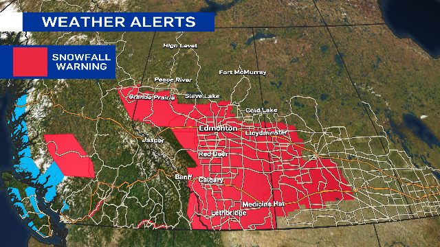
Environment and Climate Change Canada has issued a snowfall warning for a large portion of Alberta, including the City of Edmonton and surrounding areas.

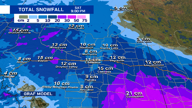
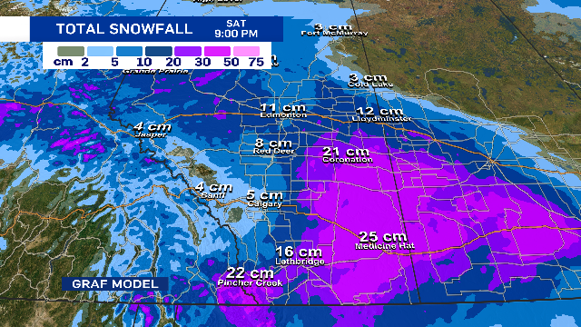
In general, most areas in that warning will get around 10 to 15 cm of snow, but there will be some spots that pick up closer to 20 cm.
The southeast corner of the province should get hit with around 20 to 30 cm.


For Edmonton and area, the snow should taper off or completely move out of the region sometime Saturday afternoon or evening.
The cold air stays in place and we’ll be in the -12 C to -16 C range for most of the weekend.
There IS a brief bump in temperature possible for Tuesday of next week. So, we’ll probably get to the -5 C to -9 C range for Tuesday.
After that, it appears we’ll see some colder air settle back in.
Here’s the forecast for Edmonton and area:
Today – A few sunny breaks this morning. Cloudy with a 40% chance of a few flurries this afternoon.
High: -10
Tonight – Periods of snow.
9pm: -12
Saturday – Periods of snow. 10-15 cm likely.
Morning Low: -14
Afternoon High: -12
Sunday – Cloudy with a few sunny breaks.
Morning Low: -15
Afternoon High: -13
Monday – Partly cloudy.
Morning Low: -20
Afternoon High: -14
Tuesday – Partly cloudy.
Morning Low: -20
Afternoon High: -8
Wednesday – Mix of sun & cloud.
Morning Low: -17
Afternoon High: -12